Město: Besh-tepa, Region: Khatlon

Zpět na článek: Tádžikistán


Navigace mapy Celého Světa online: Kliknutím a tažením na mapě Celého světa, nebo použijte zoom kontrol.

Zeměpisná šířka:

38,5333 (38°31'59.880"N)

Zeměpisná délka:

68,7833 (68°46'59.880"E)

Nadmořská výška:

765 m

Článek: Tádžikistán

Největší města: Tádžikistán

Foto, fotky: Tádžikistán

všechna města: Tádžikistán

Fórum: Tádžikistán

Největší města světa

GMT čas: +5 hodin

Posun oproti ČR: +4 hodin

Vzdálenost města Besh-tepa do 25 největších měst státu: Tádžikistán

Přímá vzdálenostKm
 Besh-tepa - Djuschambe  3 km
 Besh-tepa - Khujand  208 km
 Besh-tepa - Kulob  112 km
 Besh-tepa - Uroteppa  154 km
 Besh-tepa - Konibodom  240 km
 Besh-tepa - Kanibadam  240 km
 Besh-tepa - Kofarnihon  21 km
 Besh-tepa - Kofarnikhon  21 km
 Besh-tepa - Tursunzoda  48 km
 Besh-tepa - Regar  48 km
 Besh-tepa - Isfara  237 km
 Besh-tepa - Panjakent  148 km
 Besh-tepa - Panjkent  148 km
 Besh-tepa - Hisor  17 km
 Besh-tepa - Gissar  52 km
 Besh-tepa - Boshkengash  8 km
 Besh-tepa - Danghara  68 km
 Besh-tepa - Parkbar  128 km
 Besh-tepa - Chkalovsk  205 km
 Besh-tepa - Moskovskiy  130 km
 Besh-tepa - Tugalan  106 km
 Besh-tepa - Nurek  50 km
 Besh-tepa - Yovon  33 km
 Besh-tepa - Yovan  33 km
 Besh-tepa - Proletarsk  192 km

Vzdálenost města: Besh-tepa do Top 10 měst světa

Přímá vzdálenostKm
 Besh-tepa - Praha  4 404 km
 Besh-tepa - Berlín  4 462 km
 Besh-tepa - Londýn  5 393 km
 Besh-tepa - Los Angeles  11 915 km
 Besh-tepa - Moskva  2 994 km
 Besh-tepa - New York  10 430 km
 Besh-tepa - Paříž  5 290 km
 Besh-tepa - Peking  4 055 km
 Besh-tepa - Rio De Janeiro  13 440 km
 Besh-tepa - Sydney  11 698 km
 Besh-tepa - Tokio  6 141 km


Navigace: A B C Č D E F G H I J K L M N O P Q R Ř S Š T U V W X Y Z Ž VŠE

Podpořte nás · Kontakt· Kniha návštěv · RoboStav
Copyright (c) 2025 by CELÝSVĚT. Všechna práva vyhrazena!
Kontaktní e-mail: celysvet(zav)email.cz

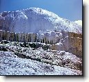

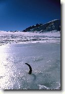
Besh-tepa
Besh-tepa


Besh-tepa
Besh-tepa


Besh-tepa
Besh-tepa


Besh-tepa
Besh-tepa


Besh-tepa
Besh-tepa


Fotogalerie ()...


Přidat foto...


Poradna
Poradna
Poslední dotazy:
HELP !


IQ test online

Hry online
Svátek má  Vladan, zítra Břetislav